Attached are some pics of our 4.25 ac retirement property in the foothills of the Smokies in East Tennessee. This is where my Power Trac earns its keep....
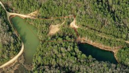
1. A satellite view, showing how the property is located between two small ponds.
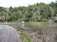
2. A view of the approximate 425 ft frontage on the larger pond, taken from the road on the other side of the pond.
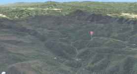
3. A MS Virtual Earth view, looking South toward the main spine of the Appalachian chain (the TN/NC border) in the Smokies. Most of the mountains are 4,000 ft plus and a few on the TN side going up to 6400-6600 ft.
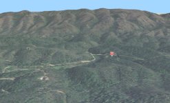
4. A MS Virtual Earth view, looking North toward the mountain that makes up the "front range." It's about 2800 ft or so, while my propery lies between 1200-1300 ft.
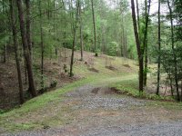
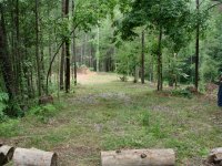
5. A view of "circular driveway" we've built, where it enters the lot, showing some of the clearing and fruit trees we've planted.
6. A view of the driveway from the rear of the lot, showing the clearing and planned building site -- where the pile of topsoil is...
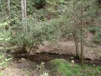
7. A view of the stream that drains the "upper pond" into the lower one that fronts the property. This stream runs down the sourthern boundary of the lot...
")