ponytug
Super Member
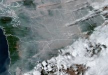
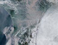
I use fire now a fair bit to find smoke plumes;

 fire.airnow.gov
and Purple Air to get detailed maps.

 map.purpleair.com
We love out Purple Air; it has kept us much healthier, and we now know that for us when it is over 50 we need N95 or P100 masks on to do outside chores. The device isn't cheap (we do have a cheap, in all senses of the word knockoff inside; 1st one lasted 14months), but it works well. Ours dates from 2015, and has been rock solid. Every couple of years, the readings will spike because a spider or something has moved in, but a brief blast of clean compressed air has it back to normal.
All the best,
Peter
AirNow Fire and Smoke Map
This map shows fine particle pollution (PM2.5) from wildfires and other sources. It provides a public resource of information to best prepare and manage wildfire season. Developed in a joint partnership between the EPA and USFS.

Real-Time Interactive Map by PurpleAir
Watch: With two minute updates, PurpleAir sensors are small, easy to install and require only power and WiFi.
We love out Purple Air; it has kept us much healthier, and we now know that for us when it is over 50 we need N95 or P100 masks on to do outside chores. The device isn't cheap (we do have a cheap, in all senses of the word knockoff inside; 1st one lasted 14months), but it works well. Ours dates from 2015, and has been rock solid. Every couple of years, the readings will spike because a spider or something has moved in, but a brief blast of clean compressed air has it back to normal.
All the best,
Peter


