dodge man
Super Star Member
I’ve done construction layout for baseball fields, football fields and track and field events. The last baseball fields I did got screwed up. Part of the problem was they didn’t update there 3d model. The other problem is the contractor didn’t check into the benchmark . I remember we had a big meeting on sight after the problem was discovered. I asked the contractor if he checked into the benchmark 2 or 3 times a day with his gps. He said what benchmark? It was clearly marked on every plan sheet.
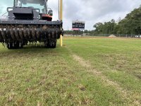
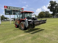
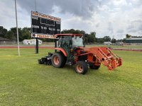
The laser setup you are using is better than gps for elevation accuracy. Just don’t forget to check the calibration and accuracy of it, they get out of whack. Also going much further than 300 to 400 feet the accuracy starts to fall off.
The laser setup you are using is better than gps for elevation accuracy. Just don’t forget to check the calibration and accuracy of it, they get out of whack. Also going much further than 300 to 400 feet the accuracy starts to fall off.