GPS Mapping?

   / GPS Mapping? #1  

Heath

Silver Member
Joined
Feb 5, 2003
Messages
101
Location
Omaha, NE
Tractor
Deere 4110 HST w/R4s
I don't have much experience with GPS, so I'm not sure if this can be done or not.
I've got a little over 5 acres with 2 buildings on it. I'd like to do some trail building and additional construction of some more buildings. I'd like to generate a map of my property that shows the locations of the buildings and some geographical features. Can I buy a GPS and mapping software that will allow me to lay out waypoints that can be downloaded into a mapping application that wwill allow me to make my own map? The map will only be good to me if it's to scale.
I think I'd mark out the corners of the property lines, the corners of the buildings, and also show edges of concrete pads, driveway locations, and other property highlights.
Does anyone know if this can be done? Has anyone done this? I know that GPS is now accurate to within a few inches since the military released the last few coordinates in their GPS grids to the public, so I don't think accuracy of GPS will be an issue.
 
   / GPS Mapping? #2  
Most (all?) GPS systems with downloadable maps use proprietary maps and that means they cost mucho money and usually aren't available for the area you want, or with the precision you need

Unfortunately, you really can't get a few inches precision, but close to 10 feet. Differential GPS can give inches resolution, but you need special equipment (surveyors use that sort of thing these days).

The approach I am using is with these two packages. http://gps.chrisb.org/gps_mapper.htm
http://kgy.narod.ru/util/mapedit/mapedit_e.htm

mapedit allows you to convert a 'raster' image into a 'vector' image, so you use an ariel phot of your property which you can scan in, or get it from http://terraserver.homeadvisor.msn.com/

You need to find a few reference points such as intersections or other things visible in the photo (in my case one intersection and a couple 'lone trees'), which you take measurements at to calibrate the image.

Then you trace your property, etc., using mapedit and export in 'polish format', which gps_mapper uses to creat a Garmin format map which can be loaded into a suitable Garmin GPS. I have an Etrex Legend and a Rhino 120.

I recommend Garmin. I blew $500 on a Magellan, which I used only once. It had trobule seeing the satellites through the trees. I guess it was great if you got lost in the city! /forums/images/graemlins/mad.gif

I am not aware of other (non-Garmin) ways of doing this.

Good luck!
 
   / GPS Mapping? #3  
Heath,

I do already roughly what your looking to do. I have a Garmin E-trex Vista and I have also ExpertGPS which will take my waypoints off my GPS and make an aerial photo. It will also mark my tracks where I walked or drove.

However, you want to get something that is fairly accurate in which I don't know of anything out there. Most GPS's accuracy is good to about 12 feet. My GPS ran about 245 bucks but I know of people that have units that run over a grand and the best they can get is about 10 feet.

Go to this discussion group and you can ask all the questions you want. It is a good discussion page. Geo-Caching

Hope this helps you
 
   / GPS Mapping? #4  
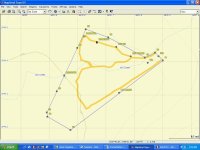
Here is a small pic of some of my trails that I have gone on. Had to reduce it from 9 meg to 100kb so not sure how it will turn out.
 

Attachments

  • 355469-Taft11.jpg
    355469-Taft11.jpg
    78.2 KB · Views: 222
   / GPS Mapping? #5  
Heath-

Short answer: Yes, you can do all that you said you want to do.

I personally have had the most experience with Garmin products and they're hard to beat. Yes there are other brands of GPS's (some are good, some are not), but I've never heard anyone complain about their Garmin.

Regarding your mapping software... I've tried several brands and found Maptech's Products are the ones I like best. I personally use Terrain Navigator (would like to have had the "pro" version, but couldn't justify the expense). They are based off of USGS maps (scanned in) and provide 3D data and views as well. (I've found this aspect very useful in pre-planning some roads across my place.) It's very easy to upload/download between my GPS and the mapping software, along with exporting/printing maps.

I'm sure there are lots of other options out there (I hate the Garmin Mapsource software, for example), but I have really liked the Garmin GPS/Maptech Terrain Navigator combination.
 
   / GPS Mapping? #6  
Heath,

I have a Lowrance GM100 that I bought several years ago that allows upload of modified maps. The maps can be modified as you indicate you want to do using a program called "OziExplorer GPS Mapping Software" that is available here http://www.oziexplorer.com/ .
OziMC is an addon to OziExplorer which allows you to create new features (roads, tracks and rivers) on OziExplorer maps and write these into new files which integrate into the Lowrance MapCreate (tm) software, the new features can be selected and uploaded to your GPS using the MapCreate software. Existing Features on the MapCreate CD can also be edited and saved. The features are added to the maps using improvements on the "track creation" methods currently available in OziExplorer. To use OziMC you will need, a Lowrance or Eagle GPS Receiver which can use the MapCreate CDROM to upload maps, version 3.83 or later of OziExplorer and the OziMC software.
OziExplorer/OziMC does not suport uploading of new maps to any Garmin GPS.

A good site for information regarding GPS is here
http://www.gpsinformation.net/

You will need a map file that you can calibrate within the program with sufficient detail for you to determine where to make your changes. I have used USGS maps available on CD with success in mapping land parcels, etc. The procedure is tedious but well worth the time if you actually need the data. At the time I bought mine, the Lowrance models were the only ones that this would work with to actually add roads, streams, etc. into your gps map. Not sure, but I think that some of the Lowrance models now aren't supported. Info should be available within the links above.
 
   / GPS Mapping? #7  
I use the Magellan route, works great under all conditions!

I collected the data with the handheld from our 30 acres, used mapedit or one of those programs to sort out the layers and colours. Exported as a shp file, used mobilemapper software to create downloadable map to gps receiver.

Not for the faint of heart. All the companies cant just use track data to show trails though, very easy.
 
   / GPS Mapping? #8  
I have the Garmin GPSIII Plus. Have had it going on 4 years now. Works great but have not used it for actual mapping of the property. Used it up in the Boundary Waters of Minnesota a few years back.

I like the comments I see here because a friend wants to get his mapped and I didn't like the Garmin Software for that part of the project.
 
   / GPS Mapping? #9  
Heath,

I don't know how much detail you want to go into, but as a neophyte, I had good luck with a Magellan Meridian and Mapsend Topo software. I located most of the pins on our perimeter and used the Routes function to draw the lines. I also located several other POI's, some of which are on the attached map. I verified the readings on a second trip and also recorded several Tracks, such as the actual creek meanderings and the roads on the property.

The program does not have the ability to calculate area /forums/images/graemlins/confused.gif, but I exported the coordinates to GPS Utility and the area identified by my readings is within 0.5% of the survey, which was fine for my purposes.

One reason for this exercise was to check on a small orchard that my neighbor had planted near the property line. It turns out, as I suspected, that it was on our property. I shared my findings with my neighbor and he called a surveyor out to disprove my contention. The surveyor verified that we now own an 18 tree peach orchard with blackberry vines along the 8 foot deer fence, all irrigated by my neighbor's well. /forums/images/graemlins/grin.gif

He and his wife were mortified and offered to remove the orchard. Instead, we know have a year-to-year lease agreement where we get a few peaches and blackberries from them if they make a crop.
 

Attachments

  • 356258-Map.jpg
    356258-Map.jpg
    96.5 KB · Views: 149

Tractor & Equipment Auctions

Telehandler Hydraulic Stabilizers (A45336)
Telehandler...
3ft Cultipacker (A47809)
3ft Cultipacker...
AGT SSECAG-Y Quick Attach Auger (A46443)
AGT SSECAG-Y Quick...
1998 Freightliner FLD120 Sleeper Cab  Detroit Diesel Series 60 Engine, 10-Speed Rockwell (A46878)
1998 Freightliner...
Standard Ply Hay Saver (A47809)
Standard Ply Hay...
12 ft Trailer (A46683)
 
Top