Property corner markers

   / Property corner markers #41  
Now throw in the fact that the length of the US survey foot changes to match the length of the international foot Jan 1 2023. I wonder how that will effect new surveys and trying to incorporate the previous shorter foot into the mix.

Not much. It comes down to the metric conversion, which I know doesn’t make sense but that is the way it works. 3.2808333333 Us feet=1 meter. 3.28 international feet=1 meter. If my math is correct a distance of 1000 feet will be 999.75 feet international. It’s really only and issue when going between meters and feet.

To further complicate things, and a good example of why coordinates can be mis used, what happens to the coordinate system in Illinois? They are also a conversion from metric. In my area the numbers are in the 1 million and 2 million range, so when converting to international feet instead of US feet, it impacts the coordinates something like 20 feet. They are also coming out with a group of new coordinate systems by county or a group of counties in Illinois. So you can see the problem with coordinates, US feet, international feet, or the new low distortion system?

Most states have been using the international foot all along, just Illinois and a few other states are changing.
 
   / Property corner markers #42  
I once ordered a load of fill and as I spread it out found a property corner marker in it.
The markers used at a time around here were 2 ft aluminum 'pegs' with barb wings that had the data stamped on the sides.

Being a very rocky terrain many of them were often poorly installed and many were intentionally moved by owners to accommodate a project.
I'm surprised we haven't seen any line disputes to date.
Being a 'pioneer' on this lake I could relate some interesting tales.
The whole lake was crown land subdivided to allow pioneer cottage building.
You leased, built and then could purchase for a token amount.
Very much as those old adds in magazines for free land.
 
   / Property corner markers #43  
My lot is what used to be two, that at one time were both owned by one that was split into many.

Simplified, one family owned hundreds of acres. ........

The whole process needs to be dramatically simplified nationwide. With technology, I see no reason why everything isn't done by GPS coordinates, with deeds simply referencing those digital points. Trees die and decay, rocks and pins get moved. Consumer level devices are accurate to within 10' usually and higher resolution equipment is available for legal description use.

Pins? Pins? We don' need no steenking pins!!!!

I have a different perspective. My 40 acres, like yours, was once part of a much larger tract, since split and re-split; sold and re-sold. My 6 corners (land is ell shaped), are marked by 8 pieces or rebar set in concrete (The two additional pins mark a "corner" on my side of the road. In other words, the road is on my "property" along two sides. So there is one pin on each side of the road.) One original fence was not on the property line. It started at a corner but angled into the adjoining parcel. I had the new fence put exactly on the line. Having those pins is simple. No need for a piece of equipment with high tech satellites orbiting the earth. See that pin/rebar in concrete? That is the corner. In addition to those pins there are fences marking all but one line.

Those pins/rebar in concrete corners are simple and easy to see. When an adjoining tract sold (This is the tract that would turn my ell into a rectangle), I had to have serious conversations with the agent, the agent's boss and the buyer. The agent had included in the property description a feeder. The problem was the feeder was my feeder on my property. The agent and seller knew what they were doing. There were puffing to sell that tract for as much as they could get. The buyer was being misled as to what he was buying. Having those marked corners and fence cleared up a lot of confusion. And I had to make it very clear that that was my fence and that I had paid for it. I even showed them a copy of the paid bill for it. For a while the new owner pushed back, just going on my property when he felt like, twisting strands so he could go through the fence. I conspicuously tightened the fence. I stayed civil but firm. Simple, my ground, clearly marked. The new neighbor has come to accept the surveyed and clearly marked boundary.

Pins, steenking pins are valuable.
 
Last edited:
   / Property corner markers #44  
The problem with Chain of Custody, and Deeds filed at the County Courthouse, is that they are based upon the idea that the information they contain is correct, and this is not always the case. ....
But surveying is a real issue in 2020. In Maine anyway, there are not enough surveyors anyway, and they charge entirely too much. I had just ONE line surveyed, and it cost $600...and they never surveyed it right, nor all the way to the pins. But I own hundreds of acres of land, in (5) towns, and (2) states...there is NO WAY I could afford to have it surveyed. So you rely on the surveys that were done from years past...

In my case, an error was made by the surveyor who wrote the description for my 40 acres. If you followed the metes and bounds, you realized that he was either describing a 60 acre, not 40 acre tract, or that the metes and bounds did not bring you back to point of beginning. Long story short, it was fixed and my title now describes an accurate 40 acres with the metes and bounds following the property line. But I paid $1,200 to have the ground resurveyed. He verified the corners (they had been set right, just the description was screwed up and that I was getting 40 acres.). That was a well spent $1,200. It has saved me grief, time and what could have been expensive lawsuits. Yes, $1,200 is a lot of money but for what I got, it was well spent.
 
   / Property corner markers #45  
My deed is fairly easy to read and understand,
It follows stone walls on all four sides and the footage is approximately and the directions are northerly, easterly, southerly and westerly.
Of course the stone walls are falling down and spreading out now going from a couple of feet wide to 5 or 6 feet.
 
   / Property corner markers #46  
In my case, an error was made by the surveyor who wrote the description for my 40 acres. If you followed the metes and bounds, you realized that he was either describing a 60 acre, not 40 acre tract, or that the metes and bounds did not bring you back to point of beginning. Long story short, it was fixed and my title now describes an accurate 40 acres with the metes and bounds following the property line. But I paid $1,200 to have the ground resurveyed. He verified the corners (they had been set right, just the description was screwed up and that I was getting 40 acres.). That was a well spent $1,200. It has saved me grief, time and what could have been expensive lawsuits. Yes, $1,200 is a lot of money but for what I got, it was well spent.

Even if you have flat, very open terrain, that $1,200 was inexpensive.
 
   / Property corner markers
  • Thread Starter
#47  
Down the road a piece, a triangular plot was divided. The intention was sales. The surveyor came all the way back to my SE corner to establish coordinates. My SE corner is a marked quarter corner. The triangle was divided into three equal pieces - approximately 30 acres each. Zoning out here requires minimum 20 acre lots. I've heard the completed survey was a bit more than $5000.

My SE quarter corner survey is some 30 years old. This surveyor came to my house to see if I wanted a new marker established. The old one was off by two inches. I thanked him and said - No, leave the old marker where it is.

If two inches made any difference - I would have been dead thirty years ago.
 
   / Property corner markers #48  
I’m not sure how he said the marker was off two inches. Today we am measure two inches difference in a half mile. 35 to 40 years ago you couldn’t. The marker is the corner unless it’s been disturbed.

One important point is our job as a surveyor is not to correct past mistakes. If a corner is suppose to be 1000 feet from another and it measures 999 feet do we move it? Do we set a new one? Not me, on my plat I show measured 999.00 feet and platted 1000.00 feet. I show the error but the found monument represents the corner. The only time a corner shouldn’t be used is in the case of gross error or fraud is involved .
 
   / Property corner markers #49  
The land company I was working for about 30 years ago sold off 5 acres from a larger tract of land, hiring a survey company to lay out the parcel and set the pins. After the work was done somebody realized that the state highway R/W was wider than what they had used, so the company came back and moved them farther back. (I believe that it was a 23 0r 35 foot difference.) I was sent out one to connect the dots... brushing, spotting and blazing between the pins. I found that they had added the distance twice, and the pins had been moved double the distance of their initial error. In the overall scheme of things there wasn't much land involved and they just let it slide.
They never hired that survey company again though.
 
   / Property corner markers #50  
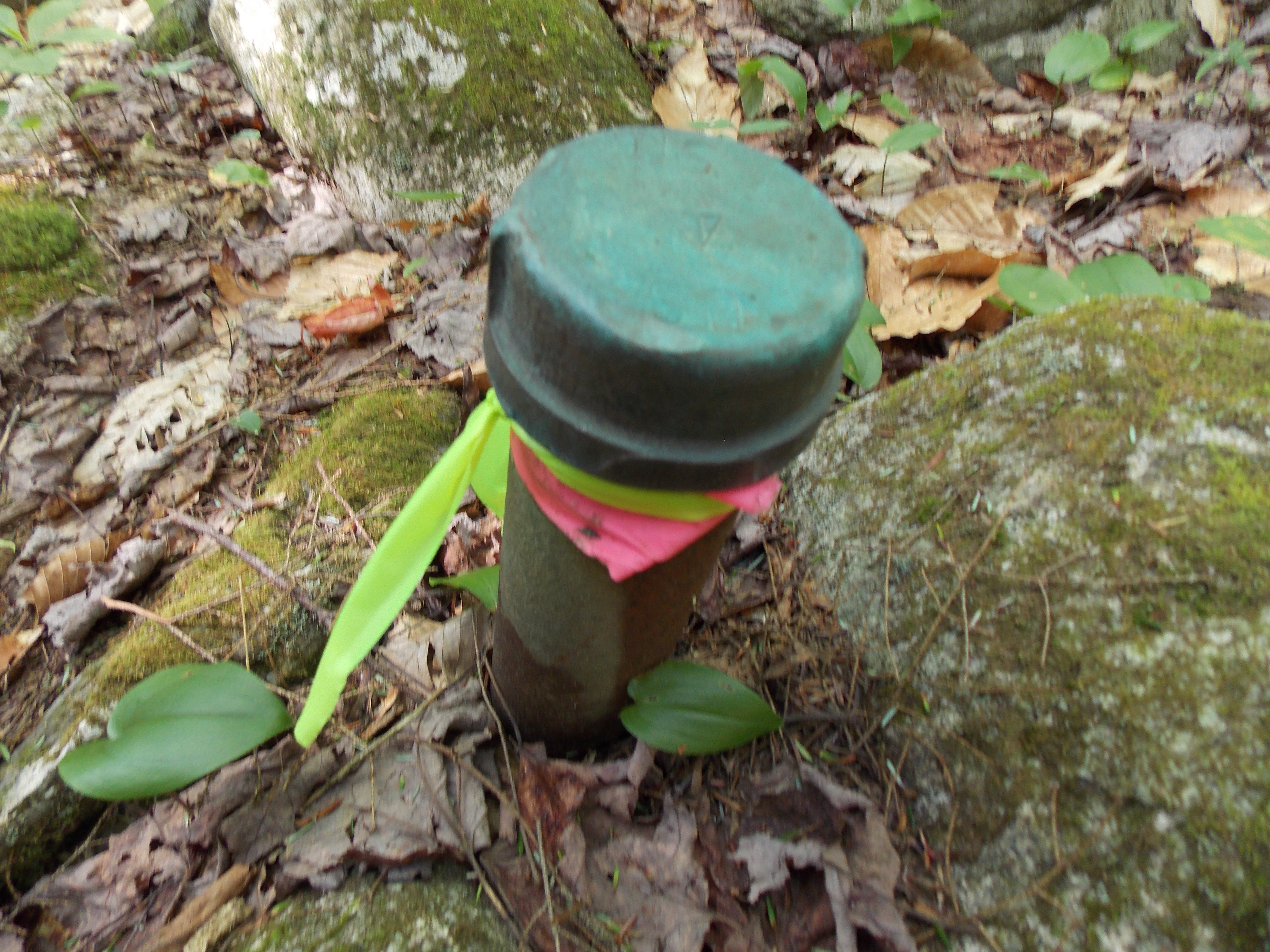
Here is one of my property pins, marking a section of my land that belonged to the Federal Government from 1932-1946. If you look close, you can see the triangle that shows the direction of the property line, and the US Geological Survey stamp. This post was driven in 1932 and holding up well.

If a person is into geology, interestingly, the borings in this area show that the gravel descends down to 32 feet, and comprises of 8 acres. That is 407,000 cubic yards, at $2 a cubic yard... You do the math.

These kind of assays are important when taken in totality.


Top