site for aerial views of your property

   / site for aerial views of your property #2  
This site is way cool! Took me a bit of time to recognize my little town from 200k miles up and a decade in the past, but sure enough, there's my house and car!

Pete

www.GatewayToVermont.com
 
   / site for aerial views of your property #3  
Pete,
About a year ago some guy came around to the house trying to sell aerial photos of our house to us. I didn't see it but it had alot of the neighbors houses in it as well. Only cool thing was that I was cutting the grass with the Kubota at the time! But my wife thought the price was way too high ( about $40.00) Have to wait for the next guy to come along and take a photo, maybe he will catch me out on my new tractor!

18-30445-von.gif
 
   / site for aerial views of your property #4  
Ekim,

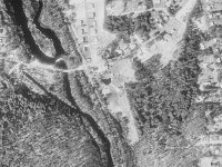
Besides the Terraserver site check your county mapping/GIS office. The county where my property resides is not exactly cutting edge but they have maps/property records on the Internet. You can see Sat pictures of the property as well as property boundries, ownership, etc. At the county office they have even better pictures from airplanes. You can see the root balls of downed trees in the forest, cars, tractors, etc. They sell the pictures, not real good quality with the prints they make, but interesting anyway. I think they were about $5 the last time I was in the office.

Hope this helps...
Dan
 
   / site for aerial views of your property #5  
Also you can go to http://www.mapquest.com and do something similar. They don't have maps for everywhere, but when they do, you can switch back and forth between the "map" view and the aireal photo. Give it an address to map, then click on the photo tab.

The GlueGuy
 
   / site for aerial views of your property #6  
Once you find yourself on teraserver, you can order the full resolution Orthophoto from the USGS online. They only cost about $7-$8 each, but there is a $50 "setup" charge, so I batched a bunch together to buy at one time to reduce the per-photo price. They are about 40MB and resolution seems to be about 1 meter per pixel. After you order they post them on an FTP server where you can grab them. I think CD and tape were options too.
 
   / site for aerial views of your property
  • Thread Starter
#7  
Peter, are the images any closer/clearer or better than they are on the website?Do you have a sample of the ones you received? Here`s my property view, do you think i can get a better image? Thanks, Mike.
 

Attachments

  • 6-58077-aerialview.jpg
    6-58077-aerialview.jpg
    100.7 KB · Views: 89
   / site for aerial views of your property #8  
I've compared the images from Terraserver and MapQuest, and the Mapquest image is larger, and newer (2000) than the Terraserver(1991) version.

The MapQuest image is so accurate, it's downright scary. Can make out the water storage tanks out back, see my wife's van in the driveway, and even where we cut our fire break.

The GlueGuy
 

Tractor & Equipment Auctions

(8) 2 PLUG VALVES (A52472)
(8) 2 PLUG VALVES...
2018 PETERBILT 579 TANDEM AXLE SLEEPER (A52141)
2018 PETERBILT 579...
2014 Acura ILX Sedan (A51694)
2014 Acura ILX...
Power Unit (A50121)
Power Unit (A50121)
Ez-Go Shuttle 2 Electric Golf Cart (A50121)
Ez-Go Shuttle 2...
2012 Ford F-450 Altec AT200A 30ft Bucket Truck (A50323)
2012 Ford F-450...
 
Top