hayden
Veteran Member
- Joined
- Sep 23, 2000
- Messages
- 2,492
- Location
- VT
- Tractor
- Kubota L5740 cab + FEL, KX121, KX080, Deere 6120M
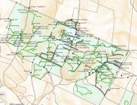
I've been using Gaia as well, and have historically been doing my map work in ArcGIS. But recently I switched to QGIS for mapping which I really like. I haven't tried it yet, but it's available to run on an iPad so my goal is to get map creation and field work all on a single platform. So far that has been elusive, but I'm optimistic that I am close to getting there.What do you use for GPS? I use either GiaiaGPs or Huntstand to map the trails and tune up stand locations in a Paint app. Here is our 80 acre hunting area.
View attachment 766711
Here's an example map with top lines. I can also overlay on sat photos, etc.
