Maybe they're exempt because it's a government facility on federal property or because they're too far out for any cell service and/or not even on anything that could be considered a road?
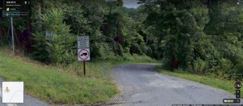
I do see 911 addresses posted at snowmobile trail intersections out in the middle of nowhere, something on the idea of 9742 Corridor 42.
As far as being stationed that far from anywhere...I'm kind of a hermit but not THAT much of one!! Might be OK for a week or 2 though.
That station gets thousands of people through it every summer as they float the middle fork, and we close it for the winter. We do have one lookout, in the middle of the wilderness, that you have to hike five miles to get to after you get to the end of the horse trail. Been to it once, about a decade ago.
Then the fire kids figured out I’m in my sixties, and won’t let me do anything physical. Went out to find four septic tanks and get them pumped. Anytime i picked up a tool, they would take it back, and tell me I’m the brains, and they are the backs. Finally asked them what was going on. And one of them told me that their crew boss, had told them that if they let me get hurt, there would be hell to pay.
So, I went to where he was digging, and helped him. He just made a comment about me being as stubborn as his Dad, and told me to let him know if I got tired.
And, we had quite a few stations and lookouts, that had never been given addresses. All the local 911 responders know exactly how to get to them if they are drivable. Most of them worked for the Forest when they were younger.
Most of the back country pilots know where the ones you can’t drive to are. You can see from peak to peak, and lookout site to lookout site. They use them as way points if they haven’t got GPS instrumentation. Interesting trivia, is that you can get a strong cell signal at most of the lookouts, because you have line of sight to a cell tower.
I had to get addresses for them, because someone in Washington, decided we needed to clear up all the deficiencies in our buildings, and real property database. Buildings on roads are easy, the roads guy, has the station, mileage to all of them. So, we just made those up, and let the Counties know what we had come up with. One of the three County Clerks got pissy about it. The other two were fine with it.. Just about all hikers have some form of GPS tracker, satellite communicator, they use if they get into trouble, so the Dispatcher knows what Lat and Long they are at.
All this computerized mapping has some strong advantages.