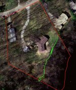
survey stakes and neighbors

   / survey stakes and neighbors #41  
KentT said:

Unfortunately, your assessment is correct. ( for fun, research the "Benson surveys" or "bar room surveys").
As to your taxation, in many jurisdictions, you can challenge your assessed acreage with a survey plat/map done by a licensed/registered surveyor/engineer. The jurisdiction may require the plat/map to be reviewed/recorded which may add substantially to the cost though.
 
   / survey stakes and neighbors #42  
KentT said:

There are hacks in every profession. Acreage is at the bottom of the list on the "Dignity of Calls" If your neighbor's 3rd surveyor encroached on your property simply to give his client deed acreage, then he should be reported to the State Board.
We pull all adjoining deeds, going beyond current ownership to the origin of the parent tract. Quite often, any ambiguities can be attributed to the property not having been surveyed in the first place, but rather just having a lawyer prepare a deed from an "office survey".

Bruce
 
   / survey stakes and neighbors #43  
KentT said:
...and no two of them necessarily will agree...

Ain't that the truth! My property is actually two adjacent lots. We had two surveys, one to buy and one to build. Both were close (within a few feet of each other), but both showed the two lots overlapped each other, I lost about 1/3 acre in the overlap. The kicker was that when my neighbors did their survey they places the marker 10' into their property, according to them I own half their driveway :) Luckily they're friendly folks so I'm sure we'll be able to work things out. I don't understand why they didn't just use a GPS location last time they surveyed in the late 1800s...
 
   / survey stakes and neighbors #44  
jdbower said:
I don't understand why they didn't just use a GPS location last time they surveyed in the late 1800s...

Hah, they did, but back then it was daylight only and inner ear followed by major standout landmarks, hand scribed.

It hasn't changed too much. :)

-Mike Z.
 
   / survey stakes and neighbors #45  
Looks like we've got a couple of experienced folks (perhaps surveyors) speaking up here...

I have a question -- growing up in the hills of East Tennessee, in the foothills of the Smoky Mountains, the land is often quite steep and full of variations in terrain of all types -- hills, valleys, rock bluffs, gulleys/ravines, etc. The "more-or-less" acreage statement on older deeds can vary by huge amounts from the acreage computed by modern surveyors and modern equipment. Another example, our family farm lay almost entirely on a side of a 2800' mountain, from its base to slightly across the crest. Its acreage was recorded in three different official places (Register of Deeds, Tax Assessor and ASCS office) as 136 acres, 165 acres and 196 acres -- though I can't remember which was which...

I've been told that old surveys tried to take into account the "3-D topology" of the terrain in their acreage computations, consequently the "more or less" was just an estimate that considered the topography, while modern surveys treat the boundaries as if the land were totally flat. Is that truly the case?

For example, in a 3-D model of a large piece of property that is full of hills and valleys, if you consider the area (i.e. acreage) on the face of all those hillsides, it could easily increase the acreage by 1/4, 1/3 or more....
 
   / survey stakes and neighbors #46  
KentT said:
For example, in a 3-D model of a large piece of property that is full of hills and valleys, if you consider the area (i.e. acreage) on the face of all those hillsides, it could easily increase the acreage by 1/4, 1/3 or more....

Yeah. My dad owned a piece of property that was a little over an acre if surveyed looking straight down from the sky. The city tried to tell him it was over two acres if they measured the surface areas. There was an escarpment that was on a slope. From the top of the "hill" if you walked straight forward 40 feet to the property line you would have about 90 feet air under your feet! :eek:

In the attached photo you can see that from the air, the area below the green line doesn't look too large. But when you get on it, it is well over an acre of surface area and almost the same size as the "flat" land above it!
 

Attachments

  • Homestead.jpg
    Homestead.jpg
    48.6 KB · Views: 205
   / survey stakes and neighbors #47  
MossRoad said:
In the attached photo you can see that from the air, the area below the green line doesn't look too large. But when you get on it, it is well over an acre of surface area and almost the same size as the "flat" land above it!
Yes, on that steep slope the aerial view would be incredibly different from that on the ground...

Here's my family's homestead, showing the rough property lines traced on the mountainside -- there's also about 40 acres across the road that you can't see in this picture. You can see how the elevation would impact the calculation of the area:

seymour_a2.jpg
 
   / survey stakes and neighbors #48  
The original 13 Colonies, and parts of Ohio are all "meets and bounds" or bearing and distance states, which means survey within those states are nightmares to deal with. The horizontal distance is the based on a level distance, not a "lay of the land" or topography distance. Neighbors should, under the best situations, share in a boundary survey and record a "boundary agreement" in their county.

Western states and most of Ohio were all surveyed under the "government subdivision" method, except for Texas. They all have section, township and range designations, which makes it much easier to calculate and find original corners, and determine property lines. A section is 640 acres and is one mile square, with a township having 36 sections. Most all of the western states were surveyed under government contracts and took place from the late 1800's up to 1910. Reading some of those old survey notes is very interesting, and finding some of the section corners from reading those old notes can be alot of fun or very frustrating.
 
   / survey stakes and neighbors #49  
pappy19, I understand thoroughly your description and distinctions. My ex-wife is a career paralegal/title-examiner who has dealt with deeds and surveys and boundaries in Tennessee, Texas, Colorado and Utah...

My question, which you've partially answered is about the "acreage calculation" (not the boundaries) that can be recorded as "more or less" on both the surveys and deeds...

I know that the recent survey done on my tract actually included the sq ft calculation based upon the boundaries, which was then converted to 4.25 acres. However, if that was done manually on the original survey and plat, which recorded it as 5.26 acres "more or less" surely there was not almost 20% error due to the manual (as opposed to computerized) calculations of acreage...

How do you explain that amount of error, if it cannot be ascribed to topography?

BTW, we're not talking about that complex a shape, nor that big of an area. See this link (not to scale).

http://static.flickr.com/35/71572952_f6c07d0d15_o.gif
 
Last edited:
   / survey stakes and neighbors #50  
Kent-

The bearings and distances should be on your warranty deed. Whatever the case, have your wifer purchase a program called "Deed Plotter", by Greenbriar Graphics, 304-484-7034. All you do is plug in the numbers, no matter how many turns, etc and it will tell you exact acerage and will also tell you if the bearings and distances will close, so you can know if it is correct. It will also tell you if it doesn't close, what the bearing and distances must be changed in order to close. We use it every day in our work to check the surveyors and the deeds for correctness. We find alot of errors as most landowners and title companies never check the survey. Some recorder's and/or assessor's will run the deeds if there is a split, but hardly ever if it is just a parcel transfer.
 

Tractor & Equipment Auctions

2015 Ford Transit 350HD Cargo Van (A44571)
2015 Ford Transit...
Wacker Neuson BS600 Compactor (A42203)
Wacker Neuson...
2011 Mazda CX-9 SUV  Spacious, Stylish, and Fun to Drive  Video Preview Available (A46877)
2011 Mazda CX-9...
2018 Ford F150 XL Single Cab Pickup Truck (A44572)
2018 Ford F150 XL...
2010 International 7600 T/A Ox Bodies 14FT 12Yd Dump Truck (A44571)
2010 International...
2025 JMR 72in Grapple Tractor Attachment (A44571)
2025 JMR 72in...
 
Top